- Tytuł:
-
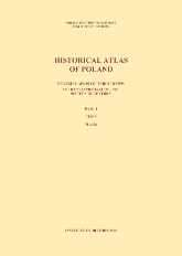
Polish lands of the Crown in the second half of the sixteenth century. Part 1, Maps, plans
Historical Atlas of Poland / Polish Academy of Sciences. Institute of History ; Collective Edition - Współwytwórcy:
-
Institute of History of the Polish Academy of Sciences
Instytut Historii im. Tadeusza Manteuffla Polskiej Akademii Nauk - Data publikacji:
- 2021
- Wydawca:
- Publishing Department of Institute of History PAS
- Słowa kluczowe:
-
Poland - history - 16th century - maps
historical atlases - Poland
Polska -- 16 w. -- mapy [KABA]
Poland - historical geography - maps
Atlasy historyczne -- 1990- [KABA] - Język:
- staroangielski (ok. 450-1100)
- Prawa:
-
Creative Commons Attribution BY-ND 4.0 license
Licencja Creative Commons Uznanie autorstwa-Bez utworów zależnych 4.0 - Linki:
- https://rcin.org.pl/dlibra/publication/edition/233781/content Link otwiera się w nowym oknie
- Dostawca treści:
- RCIN - Repozytorium Cyfrowe Instytutów Naukowych
- Materiały ikonograficzne
Menu główne
Wyszukiwarka
Treść główna

