Informacja

Drogi użytkowniku, aplikacja do prawidłowego działania wymaga obsługi JavaScript. Proszę włącz obsługę JavaScript w Twojej przeglądarce.

Wyszukujesz frazę "“19th Century”" wg kryterium: Temat


Tytuł:
Petit atlas de toutes les parties du monde, A lusage de la Jeunesse [...] : contenant les découvertes des voyageurs modernes, et l'état géographique de l'Europe, d'après les derniers traités de paix : Précis élémentaire de géographie moderne des cinq parties du monde et de notions sur la sphère
Autorzy:
Tardieu, Jean-Baptiste (1768–1837). Ryt.
Poirson, Jean-Baptiste (1760–1831). Rys.
Hérisson, Eustache (1759–1816). Rys.
Tardieu de Nesle, Mme Henri. Oprac.
Data publikacji:
1817
Wydawca:
chez Tardieu-Denesle, Libraire
Słowa kluczowe:
19 w.
geographical atlases
Atlasy -- 19 w. [KABA]
19th century
Pokaż więcej
Dostawca treści:
RCIN - Repozytorium Cyfrowe Instytutów Naukowych
Materiały ikonograficzne
Tytuł:
Neue Charte des Thales von Mexico : und der benachbarten Gebirge
Neue Charte des Thales von Mexico : \b und der benachbarten Gebirge an Ort und Stette gezeichnet im J. 1804, von Don Louis Martin ; ausgearbeitet und verbessert im J. 1807 nach den trigonometrischen Vermesfungen von Don Joaquin Velasquez und den astronomischen Beobachtungen und barometrischen Messungen vom Hrn. von Humboldt durch Jabbo Oltmans ; Schleuen sc.
Współwytwórcy:
Martin, Louis. Rys.
Schleuen, J. F. W. (18..-19..). Ryt.
Geographisches Institut (Weimar)
Humboldt, Alexander von (1769–1859). Oprac.
Velázquez Cárdenas y Léon, Joaquín (1732–1786). Oprac.
Oltmanns, Jabbo (1783–1833). Oprac.
Data publikacji:
1814
Wydawca:
im Verlage des Geograph. Institut
Słowa kluczowe:
mapy ogólnogeograficzne
19 w.
Meksyk
19th century
chorographic maps
Mexico
Pokaż więcej
Dostawca treści:
RCIN - Repozytorium Cyfrowe Instytutów Naukowych
Materiały ikonograficzne
Tytuł:
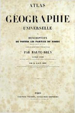
Atlas de la géographie universelle ou discription de toutes les parties du monde sur un plan nouveau daprès les grandes divisions naturelle du globe
Autorzy:
Huot, Jean-Jacques-Nicolas (1790–1845). Oprac.
Malte-Brun, Conrad (1775–1826)
Data publikacji:
[ca 1837]
Wydawca:
Garnier Fères, Libraires-Éditeurs
Słowa kluczowe:
19 w.
Atlasy ogólnogeograficzne -- 19 w. [KABA]
geographical atlases
19th century
Pokaż więcej
Dostawca treści:
RCIN - Repozytorium Cyfrowe Instytutów Naukowych
Materiały ikonograficzne
Tytuł:
Historischer Handatlas
G. Droysens Historischer Handatlas
Professor G. Droysens allgemeiner historischer Handatlas : in sechsundneuzig Karten mit erläuterndem Text
Allgemeiner Historischer Handatlas
Autorzy:
Droysen, Gustav (1838–1908)
Andree, Richard (1835–1912). Red.
Geographische Anstalt von Velhagen und Klasing (Lipsk)
Data publikacji:
1886
Wydawca:
Verlag von Velhagen & Klasing
Słowa kluczowe:
19 w.
historical atlases
19th century
Atlasy historyczne -- 19 w. [KABA]
Pokaż więcej
Dostawca treści:
RCIN - Repozytorium Cyfrowe Instytutów Naukowych
Materiały ikonograficzne
Tytuł:
Historisch-geographischer Hand-Atlas zur Gechichte der Staaten Europas vom Anfang des Mittelalters bis auf die neueste Zeit : Drei und Siebzig colorirte Karten
K. v. Srunners histor. Atlas
v. Spruners Hand-Atlas : 73 Karten
Autorzy:
Spruner, Karl von (1803–1892)
Data publikacji:
1846
Wydawca:
bei Justus Perthes
Słowa kluczowe:
Europa
Europe
historical atlases
19th century
Atlasy historyczne -- 19 w. [KABA]
Pokaż więcej
Dostawca treści:
RCIN - Repozytorium Cyfrowe Instytutów Naukowych
Materiały ikonograficzne

Ta witryna wykorzystuje pliki cookies do przechowywania informacji na Twoim komputerze. Pliki cookies stosujemy w celu świadczenia usług na najwyższym poziomie, w tym w sposób dostosowany do indywidualnych potrzeb. Korzystanie z witryny bez zmiany ustawień dotyczących cookies oznacza, że będą one zamieszczane w Twoim komputerze. W każdym momencie możesz dokonać zmiany ustawień dotyczących cookies