Informacja

Drogi użytkowniku, aplikacja do prawidłowego działania wymaga obsługi JavaScript. Proszę włącz obsługę JavaScript w Twojej przeglądarce.

Wyszukujesz frazę "Niemcy. Reichsamt für Landesaufnahme. Redaktor" wg kryterium: Wszystkie pola


Tytuł:
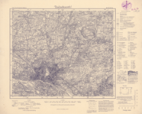
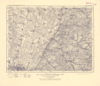
Karte des Deutschen Reiches. 31, Gr. Skaisgirren
Karte des Deutschen Reiches 1:100 000 ; 31
Autorzy:
Niemcy. Reichsamt für Landesaufnahme. Redaktor Wydawca
Data publikacji:
1924
Wydawca:
Reichsamt für Landesaufnahme
Słowa kluczowe:
Drezno (Niemcy) -- 1900-1945 -- mapy [KABA]
topographic maps
Drezno (Germany)
1900-1945
Mapy topograficzne -- 1900-1945 [KABA]
Pokaż więcej
Dostawca treści:
RCIN - Repozytorium Cyfrowe Instytutów Naukowych
Materiały ikonograficzne
Tytuł:
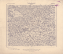
Karte des Deutschen Reiches 1:100 000 ; 134
Karte des Deutschen Reiches 1:100 000, 134. Allenstein
Autorzy:
Niemcy. Reichsamt für Landesaufnahme. Redaktor Wydawca
Data publikacji:
1939
Wydawca:
Reichsamt für Landesaufnahme
Słowa kluczowe:
Mapy topograficzne -- 1900-1945 [KABA]
Olsztyn (Polska, województwo warmińsko-mazurskie ; region) -- mapy [KABA]
Pokaż więcej
Dostawca treści:
RCIN - Repozytorium Cyfrowe Instytutów Naukowych
Materiały ikonograficzne
Tytuł:
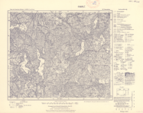
Karte des Deutschen Reiches 1:100 000, 445. Zittau
Karte des Deutschen Reiches 1:100 000 ; 445
Autorzy:
Niemcy. Reichsamt für Landesaufnahme. Redaktor. Wydawca
Data publikacji:
1940
Wydawca:
Reichsamt für Landesaufnahme
Słowa kluczowe:
Mapy topograficzne -- 1900-1945 [KABA]
topographic maps
Żytawa (Niemcy ; region) -- mapy [KABA]
Żytawa (Germany)
Pokaż więcej
Dostawca treści:
RCIN - Repozytorium Cyfrowe Instytutów Naukowych
Materiały ikonograficzne
Tytuł:
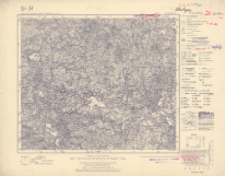
Karte des Deutschen Reiches 1:100 000, 494. Kurort Oberwiesenthal
Karte des Deutschen Reiches 1:100 000 ; 494
Autorzy:
Niemcy. Reichsamt für Landesaufnahme. Redaktor
Niemcy. Reichsamt für Landesaufnahme. Zweigstelle Landesaufnahme Sachsen. Redaktor
Data publikacji:
1937
Wydawca:
wydawca nieznany
Słowa kluczowe:
Kurort Oberwiesenthal (Niemcy ; region) -- mapy [KABA]
topographic maps
1900-1945
Mapy topograficzne -- 1900-1945 [KABA]
Kurort Oberwiesenthal (Germany ; region)
Pokaż więcej
Dostawca treści:
RCIN - Repozytorium Cyfrowe Instytutów Naukowych
Materiały ikonograficzne
Tytuł:
Karte des Deutschen Reiches 1:100 000, 514. Selb
Karte des Deutschen Reiches 1:100 000 ; 514
Autorzy:
Niemcy. Reichsamt für Landesaufnahme. Zweigstelle Landesaufnahme Sachsen. Redaktor
Niemcy. Reichsamt für Landesaufnahme. Redaktor Wydawca
Data publikacji:
1941
Wydawca:
Reichsamt für Landesaufnahme
Słowa kluczowe:
Mapy topograficzne -- 1900-1945 [KABA]
topographic maps
Selb (Niemcy ; region) -- mapy [KABA]
Selb (Germany)
Pokaż więcej
Dostawca treści:
RCIN - Repozytorium Cyfrowe Instytutów Naukowych
Materiały ikonograficzne
Tytuł:
Karte des Deutschen Reiches 1:100 000, 469. Annaberg
Karte des Deutschen Reiches 1:100 000 ; 469
Autorzy:
Niemcy. Reichsamt für Landesaufnahme. Zweigstelle Landesaufnahme Sachsen. Redaktor
Niemcy. Reichsamt für Landesaufnahme. Redaktor Wydawca
Data publikacji:
1937
Wydawca:
Reichsamt für Landesaufnahme
Słowa kluczowe:
Annaberg-Buchholz (Germany ; region)
Mapy topograficzne -- 1900-1945 [KABA]
topographic maps
Annaberg-Buchholz (Niemcy ; region) -- mapy [KABA]
Pokaż więcej
Dostawca treści:
RCIN - Repozytorium Cyfrowe Instytutów Naukowych
Materiały ikonograficzne
Tytuł:
Karte des Deutschen Reiches 1:100 000, 544. Worms
Karte des Deutschen Reiches 1:100 000 ; 544
Autorzy:
Niemcy. Reichsamt für Landesaufnahme. Redaktor
Prusy. Landesaufnahme. Redaktor
Hesja (Niemcy ; land). Landesvermessungsamt. Redaktor. Wydawca
Data publikacji:
1954
Wydawca:
Hessisches Landesvermessungsamt
Słowa kluczowe:
Wormacja (Niemcy ; region) -- mapy [KABA]
Wormacja (Germany)
Mapy topograficzne -- 1945-1990 [KABA]
topographic maps
Pokaż więcej
Dostawca treści:
RCIN - Repozytorium Cyfrowe Instytutów Naukowych
Materiały ikonograficzne
Tytuł:
Karte des Deutschen Reiches 1:100 000 ; 545
Karte des Deutschen Reiches 1:100 000, 545. Miltenberg
Autorzy:
Niemcy. Reichsamt für Landesaufnahme. Redaktor
Prusy. Landesaufnahme. Redaktor
Hesja (Niemcy ; land). Landesvermessungsamt. Redaktor. Wydawca
Data publikacji:
1949
Wydawca:
Hessisches Landesvermessungsamt
Słowa kluczowe:
Miltenberg (Germany)
Mapy topograficzne -- 1945-1990 [KABA]
topographic maps
Miltenberg (Niemcy ; region) -- mapy [KABA]
Pokaż więcej
Dostawca treści:
RCIN - Repozytorium Cyfrowe Instytutów Naukowych
Materiały ikonograficzne
Tytuł:
Karte des Deutschen Reiches 1:100 000, 460. Gießen
Karte des Deutschen Reiches 1:100 000 ; 460
Autorzy:
Niemcy. Reichsamt für Landesaufnahme. Redaktor
Prusy. Landesaufnahme. Redaktor
Hesja (Niemcy ; land). Landesvermessungsamt. Redaktor. Wydawca
Data publikacji:
1951
Wydawca:
Hessisches Landesvermessungsamt
Słowa kluczowe:
1945-1990
topographic maps
Giessen (Germany)
Giessen (Niemcy ; region) -- mapy [KABA]
Mapy topograficzne -- 1945-1990 [KABA]
Pokaż więcej
Dostawca treści:
RCIN - Repozytorium Cyfrowe Instytutów Naukowych
Materiały ikonograficzne
Tytuł:
Karte des Deutschen Reiches 1:100 000 ; 485
Karte des Deutschen Reiches 1:100 000, 485. Friedberg
Autorzy:
Niemcy. Reichsamt für Landesaufnahme. Redaktor
Prusy. Landesaufnahme. Redaktor
Hesja (Niemcy ; land). Landesvermessungsamt. Redaktor. Wydawca
Data publikacji:
1951
Wydawca:
Hessisches Landesvermessungsamt
Słowa kluczowe:
Friedberg (Germany)
1945-1990
topographic maps
Friedberg (Niemcy, land Hesja ; region) -- mapy [KABA]
Mapy topograficzne -- 1945-1990 [KABA]
Pokaż więcej
Dostawca treści:
RCIN - Repozytorium Cyfrowe Instytutów Naukowych
Materiały ikonograficzne
Tytuł:
Karte des Deutschen Reiches 1:100 000 ; 461
Karte des Deutschen Reiches 1:100 000, 461. Grünberg
Autorzy:
Niemcy. Reichsamt für Landesaufnahme. Redaktor
Prusy. Landesaufnahme. Redaktor
Hesja (Niemcy ; land). Landesvermessungsamt. Redaktor. Wydawca
Data publikacji:
1949
Wydawca:
Hessisches Landesvermessungsamt
Słowa kluczowe:
1945-1990
Grünberg (Niemcy ; region) -- mapy [KABA]
topographic maps
Mapy topograficzne -- 1945-1990 [KABA]
Grünberg (Germany ; region)
Pokaż więcej
Dostawca treści:
RCIN - Repozytorium Cyfrowe Instytutów Naukowych
Materiały ikonograficzne
Tytuł:
Karte des Deutschen Reiches 1:100 000 ; 416
Karte des Deutschen Reiches 1:100 000, 416. Döbeln
Autorzy:
Niemcy. Reichsamt für Landesaufnahme. Zweigstelle Landesaufnahme Sachsen. Wydawca
Niemcy. Reichsamt für Landesaufnahme. Redaktor Wydawca
Saksonia. Generalstab. Topographisches Bureau. Redaktor
Data publikacji:
1940
Wydawca:
Reichsamt für Landesaufnahme
Słowa kluczowe:
topographic maps
1900-1945
Döbeln (Niemcy ; region) -- mapy [KABA]
Mapy topograficzne -- 1900-1945 [KABA]
Döbeln (Germany)
Pokaż więcej
Dostawca treści:
RCIN - Repozytorium Cyfrowe Instytutów Naukowych
Materiały ikonograficzne
Tytuł:
Karte des Deutschen Reiches, 494. Oberwiesenthal
Karte des Deutschen Reiches ; 494
Autorzy:
Niemcy. Reichsamt für Landesaufnahme. Wydawca
Niemcy. Reichsamt für Landesaufnahme. Zweigstelle Landesaufnahme Sachsen. Redaktor. Wydawca
Data publikacji:
1925
Wydawca:
Reichsamt für Landesaufnahme : Landesaufnahme Sachsen
Słowa kluczowe:
Kurort Oberwiesenthal (Niemcy ; region) -- mapy [KABA]
topographic maps
1900-1945
Mapy topograficzne -- 1900-1945 [KABA]
Kurort Oberwiesenthal (Germany ; region)
Pokaż więcej
Dostawca treści:
RCIN - Repozytorium Cyfrowe Instytutów Naukowych
Materiały ikonograficzne
Tytuł:
Karte des Deutschen Reiches, 389. Halle
Karte des Deutschen Reiches ; 389
Autorzy:
Niemcy. Reichsamt für Landesaufnahme. Zweigstelle Landesaufnahme Sachsen. Redaktor
Data publikacji:
1922
Wydawca:
wydawca nieznany
Słowa kluczowe:
Halle (Germany ; region)
topographic maps
1900-1945
Mapy topograficzne -- 1900-1945 [KABA]
Halle (Niemcy ; region) -- mapy [KABA]
Pokaż więcej
Dostawca treści:
RCIN - Repozytorium Cyfrowe Instytutów Naukowych
Materiały ikonograficzne
Tytuł:
Karte des Deutschen Reiches, 414. Zeitz
Karte des Deutschen Reiches ; 414
Autorzy:
Niemcy. Reichsamt für Landesaufnahme. Zweigstelle Landesaufnahme Sachsen. Redaktor
Data publikacji:
1922
Wydawca:
wydawca nieznany
Słowa kluczowe:
Zeitz (Niemcy ; region) -- mapy [KABA]
Mapy topograficzne -- 1900-1945 [KABA]
topographic maps
Zeitz (Germany)
Pokaż więcej
Dostawca treści:
RCIN - Repozytorium Cyfrowe Instytutów Naukowych
Materiały ikonograficzne
Tytuł:
Karte des Deutschen Reiches ; 417
Karte des Deutschen Reiches. 417. Dresden
Autorzy:
Niemcy. Reichsamt für Landesaufnahme. Wydawca
Niemcy. Reichsamt für Landesaufnahme. Zweigstelle Landesaufnahme Sachsen. Wydawca
Saksonia. Generalstab. Redaktor
Data publikacji:
1927
Wydawca:
Landesaufnahme Sachsen
Reichsamt für Landesaufnahme :
Słowa kluczowe:
topographic maps
Drezno (Germany)
1900-1945
Mapy topograficzne -- 1900-1945 [KABA]
Drezno (Niemcy ; region) -- mapy [KABA]
Pokaż więcej
Dostawca treści:
RCIN - Repozytorium Cyfrowe Instytutów Naukowych
Materiały ikonograficzne
Tytuł:
Karte des Deutschen Reiches, 444. Königstein
Karte des Deutschen Reiches ; 444
Autorzy:
Niemcy. Reichsamt für Landesaufnahme. Wydawca
Niemcy. Reichsamt für Landesaufnahme. Zweigstelle Landesaufnahme Sachsen. Wydawca
Saksonia. Generalstab. Redaktor
Data publikacji:
1925
Wydawca:
Landesaufnahme Sachsen
Reichsamt für Landesaufnahme :
Słowa kluczowe:
Königstein (Niemcy ; region) -- mapy [KABA]
Königstein (Germany)
topographic maps
1900-1945
Mapy topograficzne -- 1900-1945 [KABA]
Pokaż więcej
Dostawca treści:
RCIN - Repozytorium Cyfrowe Instytutów Naukowych
Materiały ikonograficzne
Tytuł:
Karte des Deutschen Reiches, 469. Annaberg
Karte des Deutschen Reiches ; 469
Autorzy:
Niemcy. Reichsamt für Landesaufnahme. Wydawca
Niemcy. Reichsamt für Landesaufnahme. Zweigstelle Landesaufnahme Sachsen. Wydawca
Saksonia. Generalstab. Topographisches Bureau. Redaktor
Data publikacji:
1925
Wydawca:
Landesaufnahme Sachsen
Reichsamt für Landesaufnahme :
Słowa kluczowe:
Annaberg-Buchholz (Germany ; region)
Mapy topograficzne -- 1900-1945 [KABA]
topographic maps
Annaberg-Buchholz (Niemcy ; region) -- mapy [KABA]
Pokaż więcej
Dostawca treści:
RCIN - Repozytorium Cyfrowe Instytutów Naukowych
Materiały ikonograficzne
Tytuł:
Karte des Deutschen Reiches 1:100 000, 417. Dresno
Karte des Deutschen Reiches 1:100 000 ; 417
Autorzy:
Niemcy. Reichsamt für Landesaufnahme. Wydawca
Niemcy. Reichsamt für Landesaufnahme. Zweigstelle Landesaufnahme Sachsen. Wydawca
Saksonia. Generalstab. Redaktor
Data publikacji:
1941
Wydawca:
Landesaufnahme Sachsen
Reichsamt für Landesaufnahme :
Słowa kluczowe:
topographic maps
Drezno (Germany)
1900-1945
Mapy topograficzne -- 1900-1945 [KABA]
Drezno (Niemcy ; region) -- mapy [KABA]
Pokaż więcej
Dostawca treści:
RCIN - Repozytorium Cyfrowe Instytutów Naukowych
Materiały ikonograficzne
Tytuł:
Karte des Deutschen Reiches 1:100 000, 419. Bautzen
Karte des Deutschen Reiches 1:100 000 ; 419
Autorzy:
Niemcy. Reichsamt für Landesaufnahme. Wydawca
Niemcy. Reichsamt für Landesaufnahme. Zweigstelle Landesaufnahme Sachsen. Wydawca
Saksonia. Generalstab. Redaktor
Data publikacji:
1940
Wydawca:
Landesaufnahme Sachsen
Reichsamt für Landesaufnahme :
Słowa kluczowe:
topographic maps
Budziszyn (Germany)
1900-1945
Mapy topograficzne -- 1900-1945 [KABA]
Budziszyn (Niemcy ; region) -- mapy [KABA]
Pokaż więcej
Dostawca treści:
RCIN - Repozytorium Cyfrowe Instytutów Naukowych
Materiały ikonograficzne
Tytuł:
Karte des Deutschen Reiches ; 293
Karte des Deutschen Reiches, 293. Potsdam
Autorzy:
Niemcy. Reichsamt für Landesaufnahme. Wydawca
Prusy. Landesaufnahme. Redaktor
Data publikacji:
1925
Wydawca:
Reichsamt für Landesaunahme
Słowa kluczowe:
Poczdam (Niemcy ; region) -- mapy [KABA]
Mapy topograficzne -- 1900-1945 [KABA]
topographic maps
Poczdam (Germany)
Pokaż więcej
Dostawca treści:
RCIN - Repozytorium Cyfrowe Instytutów Naukowych
Materiały ikonograficzne
Tytuł:
Karte des Deutschen Reiches ; 245
Karte des Deutschen Reiches, 245. Bad Freienwalde a.d. O
Autorzy:
Niemcy. Reichsamt für Landesaufnahme. Wydawca
Prusy. Landesaufnahme. Redaktor
Data publikacji:
1924
Wydawca:
Reichsamt für Landesaunahme
Słowa kluczowe:
Mapy topograficzne -- 1900-1945 [KABA]
Bad Freienwalde (Niemcy ; region) -- mapy [KABA]
Pokaż więcej
Dostawca treści:
RCIN - Repozytorium Cyfrowe Instytutów Naukowych
Materiały ikonograficzne
Tytuł:
Karte des Deutschen Reiches ; 573
Karte des Deutschen Reiches, 573. Karlsruhe
Autorzy:
Niemcy. Reichsamt für Landesaufnahme. Wydawca
Prusy. Landesaufnahme. Redaktor
Data publikacji:
1935
Wydawca:
Reichsamt für Landesaufnahme
Słowa kluczowe:
topographic maps
Karlsruhe (Niemcy ; region) -- mapy [KABA]
1900-1945
Karlsruhe (Germany)
Mapy topograficzne -- 1900-1945 [KABA]
Pokaż więcej
Dostawca treści:
RCIN - Repozytorium Cyfrowe Instytutów Naukowych
Materiały ikonograficzne

Ta witryna wykorzystuje pliki cookies do przechowywania informacji na Twoim komputerze. Pliki cookies stosujemy w celu świadczenia usług na najwyższym poziomie, w tym w sposób dostosowany do indywidualnych potrzeb. Korzystanie z witryny bez zmiany ustawień dotyczących cookies oznacza, że będą one zamieszczane w Twoim komputerze. W każdym momencie możesz dokonać zmiany ustawień dotyczących cookies